 FAM
FAM Private Group
 Group Trips
 Celebrations
 Signature Collections
 Transformative Trips
 Luxury trips


You're offline now
Opps! Internet is disconnected.
Travel to transform: Culture Holidays' Unique Experiences.

That moment when your client trusts you completely—and you need a partner who delivers without excuses.
Join the Travel Elite—Register Now!
Tours Conducted
Travel destinations
Years of Experience
Great Company


*Scroll to read full article.

*Scroll to read full article.

*Scroll to read full article.

*Scroll to read full article.
Celebrating excellence and global recognition in cultural travel experiences
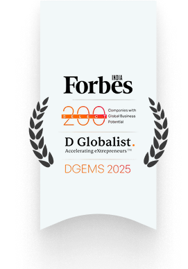
Recognized among companies with global business potential
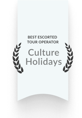
Honoring excellence in guided cultural journeys
Excellent 5 star rating reviews from travelers worldwide.

Travel To Explore
The World's Treasures With
Signature Trips.
Discover the essence of luxury and exclusivity with a Signature Trip, where every journey is crafted to deliver a lifetime experience.
One Place for all your travel needs.
Book
Travel Vacations Efficiently
Boundless
Travel Opportunities
Benefit
From Exclusive Deals.
TRAVEL TO TRANSFORM
Transform Yourself with The Best Transformative Experiences.
Embark on a transformative journey where every step unveils new insights and enriches your soul. Experience the magic of a transformative travel as it transcends mere sightseeing, inviting you to immerse deeply into diverse cultures, landscapes, and traditions. Awaken your senses and explore new perspectives with our Transformative travel journeys designed just for you.
 |
 |
 |
 |
 |
 |
 |
 |
 |

Dubai Weather: Dubai is sunny and warm throughout the year. The summer months have temperatures ranging from 33°C to 42°C. Visit Dubai between October and April for pleasant weather, with temperatures ranging from 17°C to 30°C.

Time Zone: GMT +4

Currency: United Arab Emirates Dirham (AED)

Language: Arabic
Experience the world’s tallest building, one of Dubai's must-visit attractions.....
Explore the stunning landscape of sand dunes and desert fauna for true bliss.....
Dubai Mall is the ultimate destination for shopping, entertainment, and leisure.....
Explore one of the world’s largest man-made islands and a triumph of engineering.....

Explore the most amazing destinations and fall in love with the various hues of the world.
"Meet Sarah, a dedicated travel agent who transformed her business with us. Explore her journey from novice to renowned, and start your success story today."


As she was new to the industry, she didn’t know how to begin and what resources were required to get started. She is now a successful agent, we trained her with our….
 She is now a sales champ!

Sarah had limited tour packages, but her customers wanted a variety to plan a trip. On top of that, arranging tailor-made tour packages that her customers wanted was a real challenge…


Just like yours, her customers were expecting an unforgettable travel experience, which was quite challenging for her as a newbie. Our team has made things easy for her and she…


Sarah said, “It seems hard to convince customers to buy your product and I was too struggling with the same issue.” Now, she is able to confidently pitch tours to her clients because…
Your Travelers


Her main focus was on beating the competitors and she has done everything that she could but nothing worked and brought her to her knees. Today, her business thrived with our….

Sarah also had to face challenges related to the management of the bookings. Now, she is effectively doing it without any inconvenience. She can now easily track itineraries and…
People need to talk about the Maldives more. It was an awesome experience especially if you have an over the water bungalow. The view from your deck is breathtaking. Hearing the sounds of the ocean and even watching the fish and sting rays go by in your room is an experience. The staff here is great and that spa experience was soooo relaxing. I will bring clients back here again.
Just got back from Dubai! 🥳🥳🥳 Let me first start off by saying THANK YOU Culture Holidays!!!! From start to finish you guys were AMAZING! Everyone went above and beyond for this group trip! I truly looked like a rock star to my clients!! The hotel and staff all provided a 5 star experience hands down. The location was perfect to quickly and conveniently get to everything. To our guides, OMG, you guys were truly THE best! I mean it was like literally having concierge service to every event! 😩👏🏾👏🏾🥰 I can not truly express the great pleasure I’ve had working with your company! Please keep up the good work and we’ll keep our guest coming! You have a travel partner for life.. next up Bali and I’m sure I will be at least doubling my group size from the responses I’ve gotten this far from my postings. Enjoy some of my favorite moments from this trip!
My Bali trip was amazing!!! My guests and I truly enjoyed the Culture Holidays Bali Tour🥰
This was such a wonderful trip! The Balinese people are some of the friendliest people I have met!
Discover unparalleled travel experiences with Culture Magazine's exclusive insights!
Customize Your Dream Trip, Your Way
Adult 18 years old and above.
Children under 12 years old.
 1 Adult
 0 Child
*Excluding the flight rates
Would you like to schedule a call or video call with our travel expert? (Optional)
Here's what to do next.
Great, you are all set! expect an amazing travel plan soon! ✨
Note: For a smoother experience, please don't reply directly to hello@cultureholidays.com. Instead, use the reply option in the email to chat with our travel expert.

CULTURE CONNECT
If you are already registered, please login/sign-in below
CULTURE CONNECT
If you are already registered, please login/sign-in below
CULTURE HOLIDAYS INDIA PVT LTD.
10000104211
IDFC FIRST Bank Limited
New Delhi
IDFBINBBMUM
USD
Wells Fargo Bank
#2000293914147
PNBPUS3NNYC
Wells Fargo Bank, New York
P0301
CULTURE HOLIDAYS INDIA PVT. LTD.
DBS BANK LTD.
820210180931
DBSS0IN0811
DBSSINBB XXX
CAPITAL POINT, BABA KHARAK SINGH MARG,CONNAUGHT PLACE, DELHI - 110001
693, Udhyog Vihar, Phase 5, Gurugram 122016, Haryana, India
P0301
CULTURE HOLIDAYS INDIA PRIVATE LIMITED
026073150
ach_routing_number
8339963312
Culture Holidays India
Community Federal Savings Bank
810 Seventh Avenue, New York, NY 10019, US
US
P0301

Your login session has been expired
Please click continue to extend the session or log out.

our dashboard is now faster and smarter — with clearer payments, visual rooming, and improved reporting to help you sell more with less effort. Try it now (you can switch back anytime).

Stop switching between pages and spreadsheets. Everything is now guest-wise and trackable.
Guest-wise payment
breakup
Due-date alerts &
reminders
One-click actions: Share link /
Reminder / EMI

Rooms are now cards, guests are clickable, and assignments are easy to update in seconds. No more occupancy confusion in group bookings.
Room cards with
occupancy view
Click guest → open full
details
Quick actions: Move / Swap /
Add missing guest

Convert pending payments into monthly instalments so you can stop chasing and focus on selling.
Auto monthly installment
schedule
Auto reminders sent to
guests
Clear monthly payment
schedule

Add and manage activities, upgrades, and experiences in just a few clicks —Recommend the right add-ons, assign guests instantly, and collect payments faster.
Quick add:
activities, upgrades, extra nights
Assign add-ons to
selected guests instantly
Track add-on revenue &
guest adoption
Add and manage activities, upgrades, and experiences in just a few clicks —Recommend the right add-ons, assign guests instantly, and collect payments faster.
Quick add:
activities, upgrades, extra nights
Assign add-ons to
selected guests instantly
Track add-on revenue &
guest adoption

Experience faster workflows, smarter insights, and better control over your bookings.

